
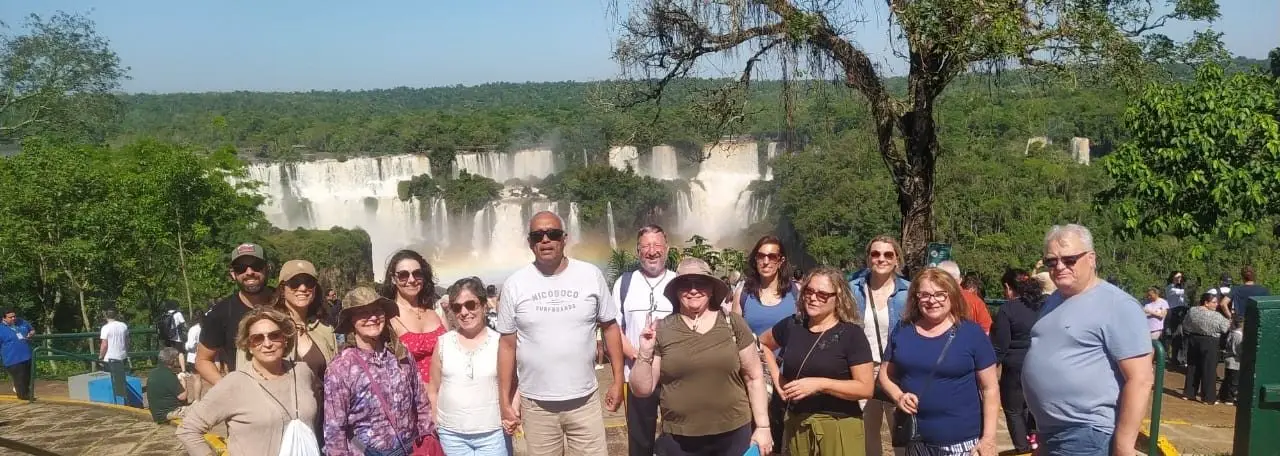
The Cataratas do Iguaçu (Iguaçu Falls) seen from the Brazilian side offer a panoramic view of the group of waterfalls formed by the Iguaçu River on the border between Brazil and Argentina, within the Parque Nacional do Iguaçu (Iguaçu National Park).
How did Iguaçu Falls form?
Iguaçu Falls formed over millions of years through the erosive action of the Iguaçu River on a basaltic rock formation, the result of ancient volcanic activity that covered southern Brazil. The river runs over layers of basalt of differing hardness and, on meeting an abrupt drop in its bed, formed where more resistant rock gives way to weaker layers eroded over time, it plunges in falls that today add up to hundreds of separate drops spread over almost three kilometres. This geological process is still active, and erosion itself continues to reshape the falls slowly over the centuries.
What is the difference between visiting the Brazilian side and the Argentine side of the Falls?
The Brazilian side of the Parque Nacional do Iguaçu is known for offering a panoramic, front-facing view of the falls, allowing visitors to see most of them from a single trail along the edge of the canyon. The Argentine side, within the Parque Nacional Iguazú, is built around walkways that bring visitors closer to the top of the falls, including the area known as the Garganta do Diabo (Devil's Throat) seen from above. The two are complementary experiences: the Brazilian side favours photographs of the whole and a general view of the canyon, while the Argentine side favours closeness to the falling water. Each country runs its own park, with its own facilities, tickets and visiting rules.
What is the Garganta do Diabo?
The Garganta do Diabo is the most intense point of the Iguaçu group of falls, where the volume of water is concentrated in a narrow, horseshoe-shaped canyon, creating a column of mist visible from a distance because of the impact of the water against the rock. It is considered the most symbolic landmark of the Falls, both for its visual force and for the constant sound of the falling water, which can be heard well before visitors catch sight of the spot. The Garganta do Diabo can be seen from different angles depending on the side visited, Brazilian or Argentine, each revealing a different perspective of the same phenomenon.
Does the Parque Nacional do Iguaçu protect only the waterfalls?
No. The Parque Nacional do Iguaçu, on the Brazilian side, preserves a large area of Mata Atlântica (Atlantic Forest), a biome that is home to species such as the red macaw, the coati and the ocelot, along with a rich diversity of birds and insects. Conserving this forest around the Iguaçu River is essential to the very existence of the falls, since the vegetation regulates the water regime of the basin and protects the banks against excessive erosion. The Brazilian park is recognised by UNESCO as a World Natural Heritage Site, precisely because of the combination of the geological phenomenon of the falls and the biodiversity preserved around them.
Is there a better time of year to visit the Falls?
The volume of water in Iguaçu Falls varies with the rainfall regime in the river basin, typically higher after rainy periods and lower during prolonged dry spells. A larger volume of water intensifies the visual and sound spectacle of the falls, while a smaller volume can reveal rock formations that are normally covered by water. Because this regime varies from year to year and park visits depend on their own opening times and availability, the safest advice is to confirm the current condition of the falls and the visiting rules directly on the park's official website.
Is Foz do Iguaçu part of an itinerary that combines with the Pantanal and Bonito?
Yes. Foz do Iguaçu is a destination on a real caravan operated by Mundo a Passeio, which brings together the Pantanal, Bonito and Foz do Iguaçu in a single itinerary through Mato Grosso do Sul and Paraná. The combination covers three distinct natural phenomena: the floodplain of the Pantanal, the clear, limestone-origin waters of Bonito and the basaltic waterfalls of the Iguaçu River. For the programme, dates and what is included in this caravan, the right channel is to confirm directly via the agency's WhatsApp.
What is the Iguaçu River and where does it rise?
The Iguaçu River rises in the Serra do Mar, near the Curitiba metropolitan area, and runs across the interior of Paraná until it flows into the Paraná River, exactly at the tri-border area between Brazil, Argentina and Paraguay. Along the way, the river crosses different geological formations, but it is only in the final stretch, over the basaltic plateau, that the drop responsible for forming the falls occurs. The name Iguaçu comes from Guarani words that refer to big water, a direct reference to the river's considerable volume in this final stretch before it flows out.
The Brazilian side of the Cataratas do Iguaçu offers the overall view that sums up, from a single vantage point, millions of years of geological formation in the Iguaçu River basin, within one of the best-preserved areas of Mata Atlântica in the country.
To continue planning, see also Ciudad del Este and Puerto Iguazú for shopping, what to do in Bonito, MS and Fazenda San Francisco and the photographic safari in the Pantanal.


